Boundary Survey Drafting Services: Data & Deliverables
Understanding what data to send and what deliverables to expect from boundary survey drafting services ensures smooth project workflows and accurate final products.
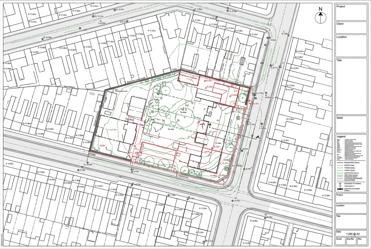
What Data Do Boundary Survey Drafting Services Need?
When you outsource boundary survey drafting, the quality of your deliverables depends heavily on the completeness of the data you provide. Professional survey CAD outsourcing partners need specific information to produce accurate, defensible drawings that meet your standards and client expectations.
Raw Field Data Files
Your field crew's data collector files form the foundation of every boundary survey drawing. Most drafting services accept data in multiple formats including:
- Trimble (.job, .dc), Topcon (.gts), Leica (.gsi), Carlson (.rw5)
- CSV or text files with point number, northing, easting, elevation, and description
- Total station or GPS raw data with complete observation sets
The more complete your raw data, the smoother the drafting process. Include all shots taken in the field, even if some seem redundant. Experienced drafters use multiple observations to verify accuracy and resolve conflicts.
Control Network Information
Your boundary survey drawing must tie to a recognized coordinate system or local control. Provide clear documentation of:
Basis of bearing information, whether true north, magnetic, grid, or an assumed bearing based on a specific property line. Include the complete description of how the bearing was established.
Coordinate system details if working in state plane, UTM, or a local system. Specify the datum, zone, and units. If you're using a custom site calibration or localization, include the transformation parameters.
Control point descriptions with coordinates for all monuments used as control, including benchmarks. Note which points are held fixed and their source (published values, previous surveys, or your establishment).
Research and Legal Documents
Boundary work requires more than field measurements. Your drafting team needs the legal framework that defines property boundaries:
Current deed for the subject property, including all metes and bounds descriptions, area statements, and referenced plats or documents. Recorded deeds are essential—title company descriptions may be abbreviated.
Adjoining deeds help drafters understand boundary relationships and identify potential conflicts. Provide deeds for all abutting properties when available.
Recorded plats, subdivision maps, and previous surveys referenced in the deed or discovered during research. Include both the subject property's plat and any adjoining subdivisions.
Easement documents for any rights-of-way, utility easements, or access easements affecting the property. These must appear on the final drawing and require accurate descriptions.
Field Notes and Sketch
Your field crew's observations provide context that raw data cannot convey. A clear field sketch showing:
Property corners found, set, or missing, with monument descriptions and their relationship to measured points. Note the condition of found monuments.
Boundary evidence including fences, walls, hedgerows, occupation lines, and any physical features suggesting boundary locations.
Improvements on the property such as buildings, driveways, utilities, and other features required on the final drawing.
Adjoiners' improvements near boundary lines, especially encroachments or structures close to property lines.
Standard Deliverables From Professional Boundary Survey Drafting Services
When you engage quality land surveying drafting support, you should expect comprehensive deliverables that meet professional standards and your local requirements.
CAD Drawing Files
The primary deliverable is a complete CAD drawing, typically in AutoCAD .dwg format compatible with AutoCAD 2018 or newer. Your drawing should include:
Properly layered linework following industry-standard naming conventions or your firm's custom layer standards. All boundary lines, easements, improvements, and topographic features should be on appropriate layers with correct line types and weights.
Accurate geometry with closed boundary polygons, precise curve data (radius, arc length, chord bearing and distance), and bearing/distance labels on all property lines.
Complete title block with surveyor information fields, project details, scale, north arrow, legend, and certification block ready for your seal.
Survey Plat or Plan
A plot-ready PDF drawing suitable for printing and submission to recording authorities. This plotted sheet should be:
Formatted to standard sheet sizes (typically 24×36 inches or as required by your county recorder) with proper margins and border.
Drawn at an appropriate scale showing the entire property with adequate space for notes, legend, and certifications.
Ready for your review and seal, with all required elements positioned according to your state's minimum standards for boundary surveys.
Supporting Documentation
Professional drafting services often provide additional files that support your review and archiving:
A coordinate listing or point table showing all measured and calculated points with descriptions. This spreadsheet helps you verify data accuracy and provides a record for future work.
Area calculations with precision appropriate to your project, typically to the nearest square foot or hundredth of an acre for boundary surveys.
A deed versus measured comparison table if significant differences exist between record dimensions and your field measurements.
Quality Standards for Boundary Survey Drawings
Reliable boundary survey drafting services deliver work that meets professional standards without requiring extensive revisions.
Accuracy and Consistency
All bearings and distances should be mathematically consistent. Boundary polygons must close with minimal error (typically 1:10,000 or better for most boundary work). Curve data should be internally consistent—radius, delta angle, arc length, and chord values must all agree.
Cadastral research should be properly reflected. Record dimensions from the controlling deed must appear on the drawing with your measured dimensions for comparison.
Compliance and Completeness
Drawings should follow minimum standards in your jurisdiction. Most states have specific requirements for boundary survey plats including:
Required notes such as surveyor certifications, purpose of survey, and basis of bearings. Your drafter should include standard language used in your state.
Legend items explaining symbols, monuments, and line types used on the drawing.
Vicinity map or location map if required by local recording standards.
White-Label Presentation
Outsourced drawings should appear as if they were produced by your firm. Title blocks, text styles, dimension styles, and overall appearance should match your standards. The client should never know the drawing was drafted externally.
Turnaround Time Expectations
Typical boundary survey drafting timelines range from 24 to 48 hours for straightforward residential properties. More complex projects with multiple parcels, extensive easements, or complicated legal descriptions may require 3-5 business days.
Rush service is often available for urgent deadlines, though this may involve additional fees. Clear communication about your timeline needs helps drafting services prioritize your work appropriately.
Revision turnaround should be quick—most corrections or minor adjustments are completed within 4-8 hours during business hours.
Communication Throughout the Drafting Process
Quality boundary survey drafting services maintain clear communication channels. You should expect:
Project acknowledgment within a few hours of submission, confirming receipt of all necessary files and data.
Questions about ambiguous data or missing information rather than assumptions that might compromise accuracy. Good drafters identify potential issues early.
Progress updates on complex projects, especially if the timeline extends beyond the initial estimate.
A review period before final delivery, allowing you to request adjustments or clarifications.
Protecting Your Firm and Client Information
Professional survey drafting partnerships respect the confidentiality of your project data. Every project should be covered by a non-disclosure agreement protecting your field data, client information, and proprietary processes.
White-label delivery means your clients receive drawings bearing only your firm's information. The drafting service remains invisible to your client, preserving your direct relationship and professional reputation.
Frequently Asked Questions
What if I discover an error in my field data after drafting begins?
Reputable drafting services accommodate field data corrections as part of the normal workflow. If you identify an error in your raw data—such as an incorrect point number, wrong description code, or measurement that needs adjustment—contact your drafting team immediately. They'll incorporate the corrected data and revise the affected portions of the drawing. Most services include reasonable revisions in their standard pricing, though extensive rework due to major data changes may require timeline adjustments. Clear communication prevents wasted effort and ensures accuracy.
Can boundary survey drafting services work with hand-drawn sketches?
Yes, experienced drafters regularly work from field sketches, particularly for retracement surveys where limited new data was collected. Provide the clearest sketch possible with dimensions, monument descriptions, and any relevant notes. Photographs of found monuments and boundary features add valuable context. If you're providing sketch and deed only without digital field data, the drafter will construct the boundary mathematically from record dimensions and plot your observed relationships. This approach works well for many projects, though having at least some coordinate data from key points improves accuracy. Consider our survey data conversion services if you have older surveys that need digitizing.
Do I need to provide my CAD template and layer standards?
Providing your firm's CAD template, layer standard, and style preferences ensures deliverables match your existing work. Most drafting services maintain custom templates for repeat clients, so after the first project, your standards are on file. If you don't have formal standards, experienced drafters can follow general industry conventions or match the style of a previous drawing you provide as a reference. Many firms use this as an opportunity to develop consistent standards if they haven't already. Quality Civil 3D survey drafting services adapt to your workflow rather than forcing you into theirs.
Get Professional Boundary Survey Drafting Support
Outsourcing your boundary survey drafting allows your field crews to stay productive while ensuring consistent, accurate deliverables. Land Drafters provides white-label boundary survey drafting with 24-48 hour turnaround times, maintaining the confidentiality and quality standards your firm requires.
Ready to streamline your drafting workflow? Request a free quote today and experience the difference professional survey drafting support makes.