CAD Conversion Services PDF to DWG for Survey Projects
Converting PDFs, scanned plats, and hand sketches to DWG format is essential for modern land surveying workflows. Professional CAD conversion services ensure accuracy while saving time on digitization.
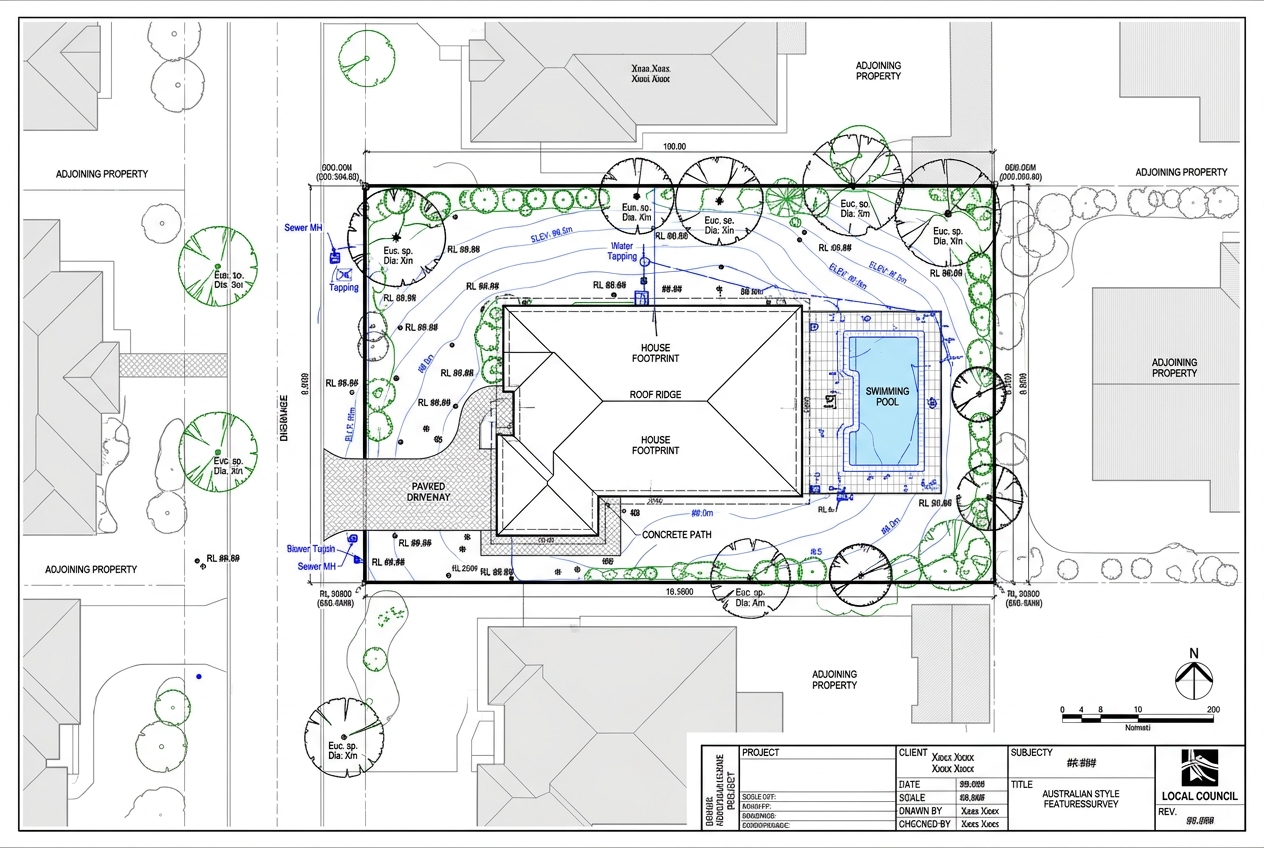
Why Survey CAD Conversion Matters
Land surveyors frequently work with legacy documents—old plats, hand-drawn field sketches, and PDF files from various sources. While these formats serve their purpose, they're not ideal for modern workflows that require editable, scalable CAD files. Converting these documents to DWG format unlocks their full potential, allowing you to overlay data, perform calculations, and integrate with other project files.
Professional CAD conversion services bridge the gap between paper-based records and digital workflows. Whether you're dealing with a century-old subdivision plat or yesterday's field sketch, converting to DWG creates a foundation for accurate, efficient surveying work.
Understanding CAD Conversion Services PDF to DWG
CAD conversion services transform static images and documents into dynamic, editable CAD files. The process involves much more than simple scanning or importing. Professional conversion requires technical knowledge, attention to detail, and quality control measures that ensure the final DWG file meets surveying standards.
The conversion process typically handles three main document types:
- PDF files from previous surveys, municipal records, or client submissions
- Scanned plats including historical subdivision maps and recorded documents
- Hand sketches from field crews showing site conditions, measurements, and notes
Each document type presents unique challenges. PDFs may contain vector data that can be extracted, or they might be flattened images requiring complete redrafting. Scanned plats often suffer from age-related deterioration, skewing, or poor scan quality. Hand sketches demand interpretation of field crew notation and coordination with field notes.
The Technical Process Behind PDF to DWG Conversion
Professional survey data conversion follows a systematic workflow designed to maintain accuracy while maximizing efficiency.
Initial Assessment and Preparation
The conversion begins with document evaluation. Technicians assess the source material quality, identify what information needs extraction, and determine the appropriate conversion method. Poor-quality scans may require image enhancement before conversion begins. Skewed documents need geometric correction to ensure angles and distances remain accurate.
Vector Extraction or Manual Digitization
For PDF files containing vector data, specialized software can extract line work, text, and other elements. However, this rarely produces survey-grade results without significant cleanup. Most survey documents require manual digitization where CAD technicians redraw features using the source document as a reference underlay.
This manual approach ensures accuracy. Technicians verify dimensions, establish proper coordinate systems, and organize elements on appropriate layers following surveying CAD standards.
Quality Control and Verification
After initial conversion, quality control checks verify that the DWG file accurately represents the source document. This includes dimensional verification, layer structure validation, and checking that text elements are readable and properly positioned. For projects with known control points or benchmarks, technicians verify the coordinate system accuracy.
Benefits of Professional Conversion Services
Outsourcing CAD conversion delivers several advantages over in-house processing. Professional survey CAD outsourcing providers maintain teams of experienced technicians who handle conversion work daily, developing efficiency and expertise that occasional conversion work cannot match.
Time savings represent a significant benefit. Converting complex plats or extensive hand sketches can consume hours or days of staff time. Professional services typically deliver completed conversions within 24-48 hours, freeing your team to focus on billable fieldwork and client interaction.
Accuracy improves when experienced technicians handle conversion work. They recognize common pitfalls, understand surveying conventions, and know how to interpret ambiguous information. This expertise reduces errors that could compromise project quality or require expensive rework.
Consistency also matters. Professional services follow standardized workflows and layer structures, ensuring that converted files integrate seamlessly with your existing CAD standards and project files.
Common Challenges in Survey Document Conversion
Even professional conversion encounters challenges. Understanding these helps set realistic expectations and explains why quality conversion services require skilled technicians rather than automated software.
Legibility issues plague many historical documents. Faded text, stained paper, and deteriorated originals make information extraction difficult. Technicians must sometimes interpret barely visible text or reconstruct damaged portions using context clues.
Scale and dimension verification presents another challenge. Not all source documents are drawn to exact scale, and photocopying or scanning can introduce distortion. Professional converters cross-check dimensions and use known reference points to establish accurate geometry.
Handwriting interpretation requires experience with surveying terminology and common field notation. Different survey crews develop their own shorthand, and skilled technicians learn to recognize these patterns.
Maintaining Quality in Converted Files
Quality CAD conversion produces files that integrate smoothly into your workflow. This means proper layer organization, appropriate use of blocks and symbols, and text that's editable rather than exploded into individual letters.
Professional services typically deliver files that match industry-standard layer naming conventions. Line work appears on appropriate layers—property lines separate from topographic features, existing improvements distinct from proposed work.
The final DWG file should also maintain appropriate line weights, line types, and plotting settings so the digital file prints identically to the original document when required.
Integration with Modern Surveying Workflows
Converted DWG files become working documents that support various surveying tasks. You can overlay GPS or total station data, integrate with Civil 3D survey drafting workflows, or combine multiple historical plats to create comprehensive site analyses.
This integration capability makes conversion services valuable even when you could theoretically redraft documents in-house. Professional conversion creates clean, properly structured files that become reliable reference layers rather than merely digitized images.
Frequently Asked Questions
How accurate are PDF to DWG conversions for survey work?
Accuracy depends on source document quality and the conversion method used. Professional manual digitization typically achieves accuracy within the precision limits of the original document. For survey-grade work, technicians verify dimensions against stated measurements and use known control points when available. Automated conversion tools often lack the precision required for surveying applications and typically require extensive manual cleanup.
Can you convert hand sketches that don't include full dimensions?
Yes, professional conversion services can digitize hand sketches even with incomplete dimensions. Technicians create scaled drawings based on available measurements and clearly note areas where dimensions were interpreted or estimated. The resulting DWG file provides a usable base that field crews can verify and update during site visits. Many firms use converted sketches as planning tools before conducting detailed surveys.
What file formats can be converted to DWG besides PDF?
CAD conversion services typically handle various formats including TIFF, JPEG, PNG, and other image formats from scanned documents. Some providers also convert older CAD formats, GIS shapefiles, or legacy software outputs. The key factor is whether the source document contains the information needed for your surveying application. Most conversions work from image files where technicians can see the original line work, text, and symbology.
Get Professional CAD Conversion Support
Whether you're dealing with a single historical plat or need ongoing conversion support for your surveying practice, professional CAD conversion services deliver accurate, timely results. Land Drafters provides expert conversion with 24-48 hour turnaround on most projects, all completed under strict confidentiality agreements. Request a free quote to discuss your specific conversion needs and discover how outsourced drafting support can streamline your workflow.